Do Norway’s Scenic Routes Elevate the Wilderness or Domesticate It?
Contemporary transport engineering is built to erase geography. The Norwegian Scenic Routes take a radically different approach. By placing bold architectural viewpoints along the fjords and tundras, the state forces us to slow down. But does framing the wild with raw concrete domesticate it?
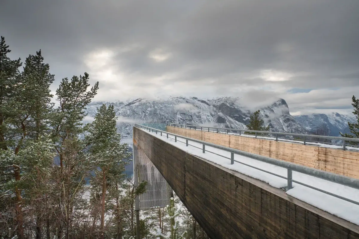
High on the flank of the Aurlandsfjellet mountain pass in western Norway, 650 meters above sea level, a four-meter-wide bridge of laminated pine and steel extends thirty meters out into the void. Designed by architects Todd Saunders and Tommie Wilhelmsen, the Stegastein viewpoint begins as a ramp opening toward the sky. At its farthest edge, the floor abruptly drops away. Visitors are met only by a thick panel of glass angled outward toward the dark waters of the Aurlandsfjord far below.
At this precipice, the body instinctively slows. The outward tilt of the glass denies the familiar habit of leaning against a railing to gaze at the horizon, forcing the eye straight down into hundreds of meters of empty air. A quiet tension emerges between the roar of the wind, the scale of the fjord, and the sharp geometry of timber suspended in space. For a state highway authority to build such an intricate architectural apparatus on a remote mountain pass simply to make travelers pause at the edge of a cliff runs entirely counter to the logic of modern infrastructure.
Contemporary transport engineering is built to erase geography. Mountains are pierced by tunnels, valleys are bridged by viaducts, and the distance between two points is reduced strictly to time. Directly beneath the Aurlandsfjellet massif where Stegastein cantilevers into the air runs the Lærdal Tunnel, which opened to traffic in 2000 and remains the longest road tunnel in the world at 24.5 kilometers. Drivers passing through this sealed tube in the belly of the mountain can cross from one fjord valley to the next in twenty minutes, insulated from weather and terrain alike.
Over the past three decades, Norway’s infrastructure history has witnessed the simultaneous rise of these two contradictory engineering visions. Even as the state blasted through bedrock to accelerate transit, it pursued a national architectural program that treated geography not as an obstacle to be bypassed, but as a reason to turn the road itself into the destination.
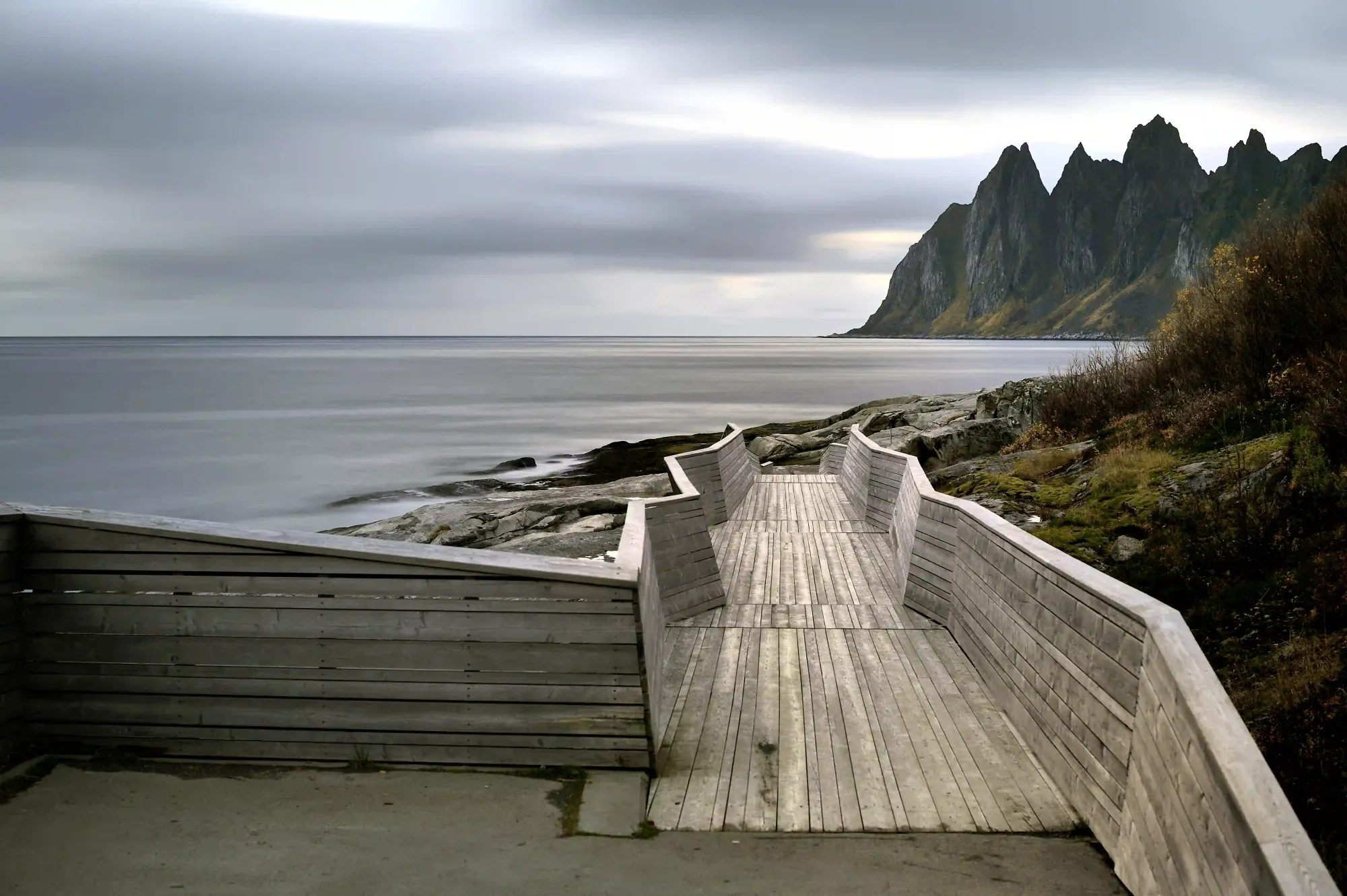
Known as the Norwegian Scenic Routes (Nasjonale turistveger), the initiative began in 1994 under the Norwegian Public Roads Administration (Statens vegvesen) as a four-year pilot covering the Sognefjellet, Gamle Strynefjellsvegen, Hardanger, and Helgeland coast corridors. The primary aim was to sustain rural economies outside major transit arteries and encourage tourism through rigorous design. Following the pilot’s success, the Norwegian Parliament (Stortinget) turned the project into a permanent national strategy in 1998. From roughly sixty proposed roads, eighteen routes were selected in 2004, and by 2012 the network had achieved official status across more than two thousand kilometers of highway.
Stretching from the coastal lowlands of Jæren in the south to the Arctic tundra of Varanger along the Barents Sea in the northeast, these eighteen routes stand apart from other scenic highways not simply because of the terrain they cross, but because of how the state choreographs the encounter with that terrain. To safeguard the aesthetic rigor of the initiative, the administration established a dedicated Architecture Council alongside an independent Arts Council. Between 1994 and 2023, the Public Roads Administration invested a total of roughly 4.4 billion Norwegian kroner (in 2023 terms) across the program, upgrading road infrastructure and realizing more than 140 architectural and artistic interventions. Leading Norwegian practices such as Snøhetta, Reiulf Ramstad Arkitekter, Jensen & Skodvin, and Carl-Viggo Hølmebakk were commissioned to design rest stops, parking areas, footpaths, and roadside public lavatories. Open competitions also gave young, experimental studios the rare opportunity to build permanent works in the public landscape.
A road does more than connect two coordinates; the moment speed drops, it becomes an optical instrument that dictates where the gaze falls, where the body stands, and which fragment of nature enters the frame.
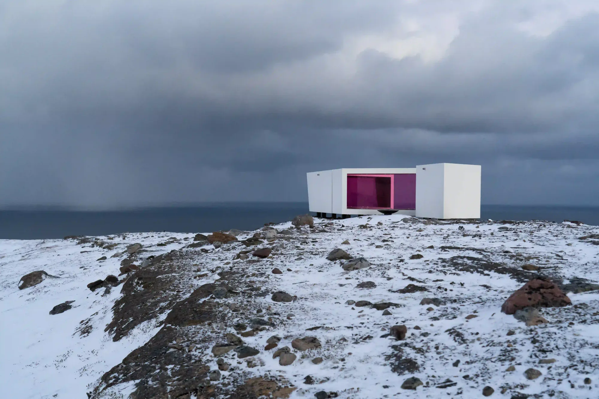
Across the program, the architecture refuses to mimic nature. Instead of the rustic log cabins often built in rural regions under the guise of blending in, these interventions rely on raw concrete, Corten steel, glass, and untreated timber. At the facilities designed by Reiulf Ramstad Arkitekter along the Geiranger and Trollstigen route, weathered steel and angular concrete planes cut directly into the mountain rock. Engineered to withstand flash floods and months of heavy snow loads, the structures draw a candid, unmistakable line between human intervention and raw geology. Further along the same route at Gudbrandsjuvet in Valldal, Jensen & Skodvin suspended a geometric lattice of steel, concrete, and angled glass panels over a churning river gorge. Walking across the metal bridge, visitors feel the tremor of the vortex beneath their feet while the parapets hold them at a measured, secure distance.
This visual contrast is paired with surgical precision on the ground; the structure announces its presence while taking extreme care not to scar the earth. Nowhere is this clearer than at the Sohlbergplassen viewpoint along the Rondane route, completed in 2006. Designing a slender, curving concrete deck that weaves among pine trees, architect Carl-Viggo Hølmebakk digitally mapped every trunk on the site. To ensure that not a single tree was felled and no root systems were crushed during construction, the platform was anchored directly into the underlying bedrock on thin steel-core pillars.
When visitors follow this concrete path around the tree trunks to the outer edge of the deck, they confront a familiar silhouette of the Rondane massif. Hølmebakk positioned the platform near the vantage point associated with Norwegian painter Harald Sohlberg’s 1914 oil painting Winter Night in the Mountains (Vinternatt i fjellene), preserved in the National Museum (Nasjonalmuseet) as one of the country’s defining cultural icons. Yet Sohlberg never painted that iconic panorama from a single spot; he synthesized sketches made from multiple angles across the region into a composite mental image. In the nineteenth and early twentieth centuries, artists reconstructed Norway’s austere terrain on canvas to forge a national identity. Today, the state fixes the painter’s composite vision onto the physical geography through a concrete viewing deck. The visitor does not merely look at a mountain range, but re-consumes an artistic image already canonized by culture.
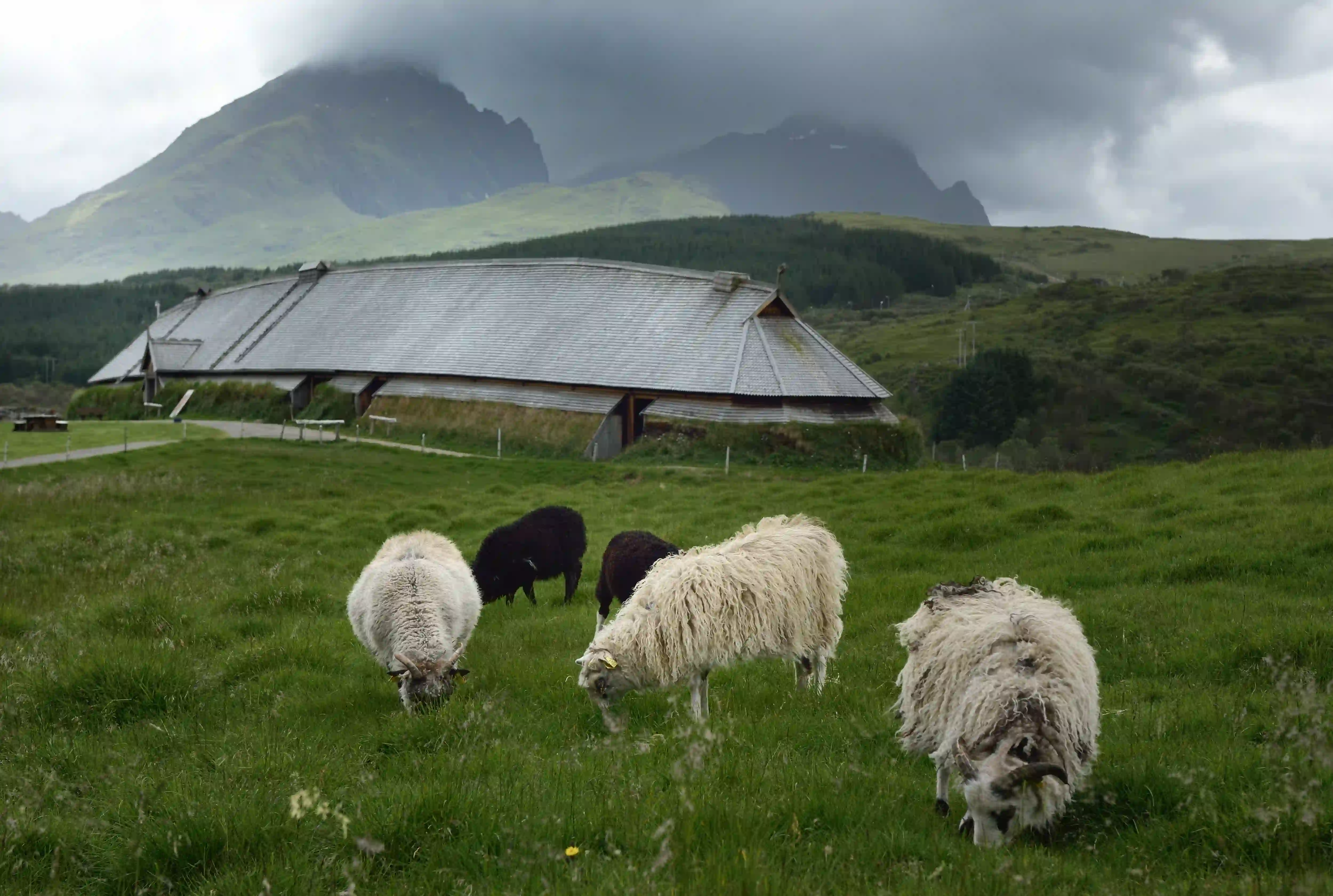
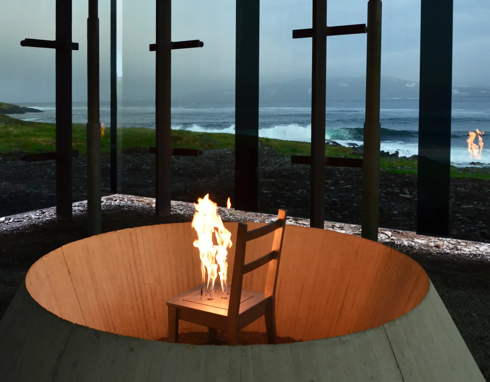
Not every structure in the program turns the landscape into an object of aesthetic contemplation. Far to the north, along the Varanger route beside the Barents Sea, the Steilneset Memorial pushes architectural framing into darker territory. Opened in the town of Vardø in 2011, the site brings together Swiss architect Peter Zumthor and French-American artist Louise Bourgeois. Running parallel to the shoreline, Zumthor’s 125-meter pine-scaffolding structure suspends a taut fabric cocoon that holds a quiet memorial to the ninety-one people executed during the seventeenth-century Finnmark witch trials. Beside it stands a stark pavilion of smoked glass and steel housing Bourgeois’s installation, where flames rise from the seat of a metal chair reflected in oval mirrors. At Steilneset, architecture refuses to romanticize the scenery; instead, it casts the windswept emptiness of the Arctic tundra as a mute witness to historical state violence.
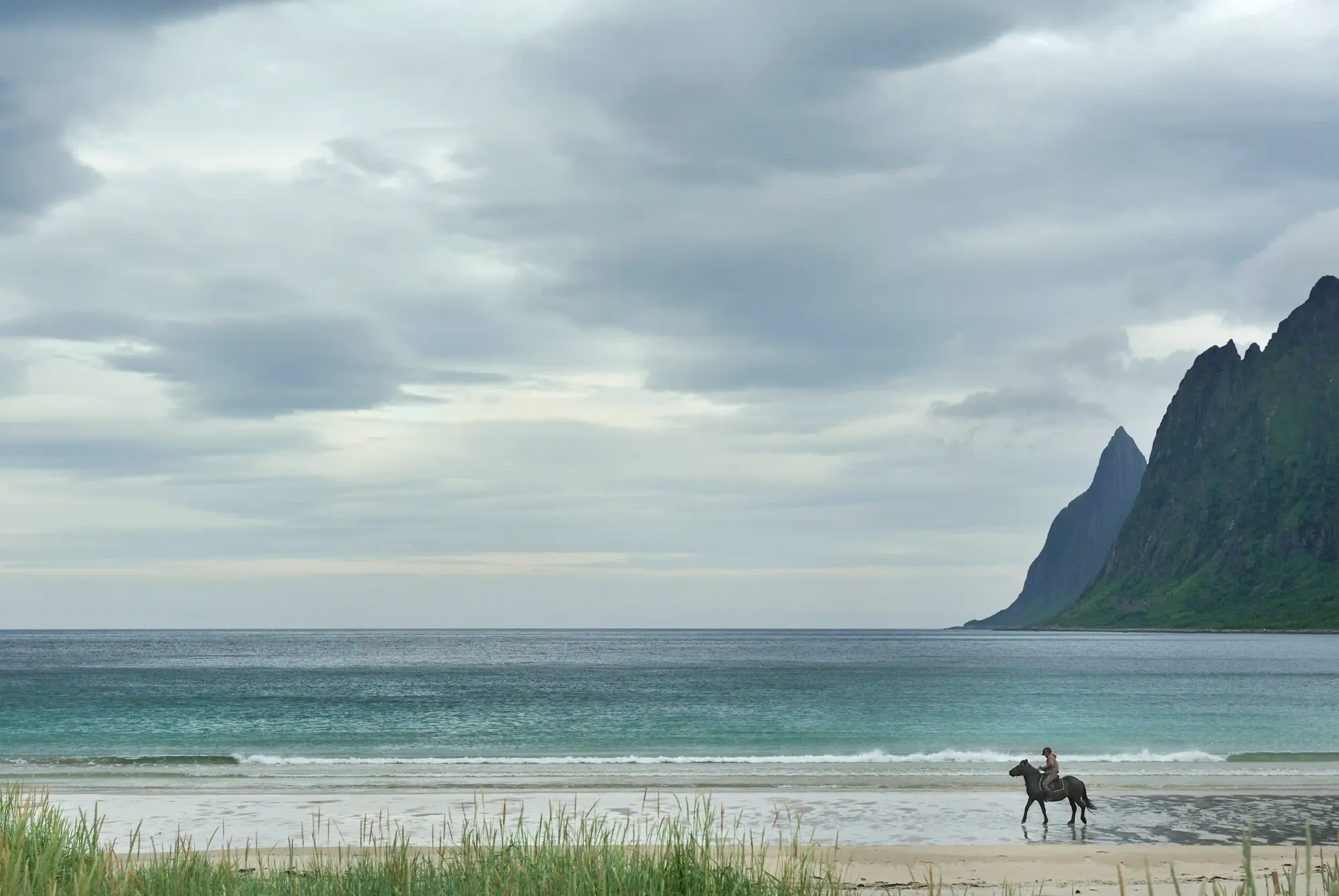
Leaving aside exceptions like Steilneset, the broader design ethos of the Norwegian Scenic Routes sits in intriguing tension with Nordic traditions of inhabiting the outdoors. Historically, the Norwegian relationship with nature has been rooted in friluftsliv (open-air living) and the legal principle of allemannsretten (the right to roam), codified in the Outdoor Recreation Act of 1957, which grants everyone the freedom to move across uncultivated land provided they act considerately and cause no harm. Within that tradition, the individual meets unmarked nature on their own footing and at their own risk.
There is, of course, a compelling ecological and social logic behind these architectural interventions. Elevated concrete and steel walkways channel visitors’ footsteps along a strict path, preventing fragile mosses, lichens, and alpine and coastal vegetation from being trampled into mud. At the same time, these platforms open sheer cliffs and high passes, once reachable only by experienced mountaineers, to elderly travelers, children, and wheelchair users, democratizing the spirit of allemannsretten.
Yet the physical shield that protects the soil and widens access inevitably introduces perceptual choreography. The placement of the parking lot, the gradient of the path from the car, the angle of the bench, and the boundaries of the photographic frame have all been decided in advance by an architect. Undertaken to preserve the landscape and make it accessible, the intervention gradually converts wild geography into a curated open-air museum. Moreover, during the peak summer months, the heavy traffic drawn to these narrow mountain and coastal roads to vitalize rural economies can turn viewing platforms built for silence and slowness into crowded stops of visual consumption.
Looking back at the Stegastein platform on Aurlandsfjellet and the Lærdal Tunnel bored through the rock directly beneath it, one can read the two extremes of our contemporary relationship with nature within a single cross-section of mountain. The tunnel below represents our impulse to annihilate geography in the name of speed. The timber-and-glass ramp above is a self-imposed architectural rule designed to make us pause and feel that geography once again.
The concrete, steel, and timber structures strung along Norway’s eighteen routes simultaneously elevate the wilderness and domesticate it, proving that in the twenty-first century even our reverence for untamed nature relies on a designed boundary. To truly pay attention to a wild landscape and slow down before it, it seems we first need an architect to put it in a frame.